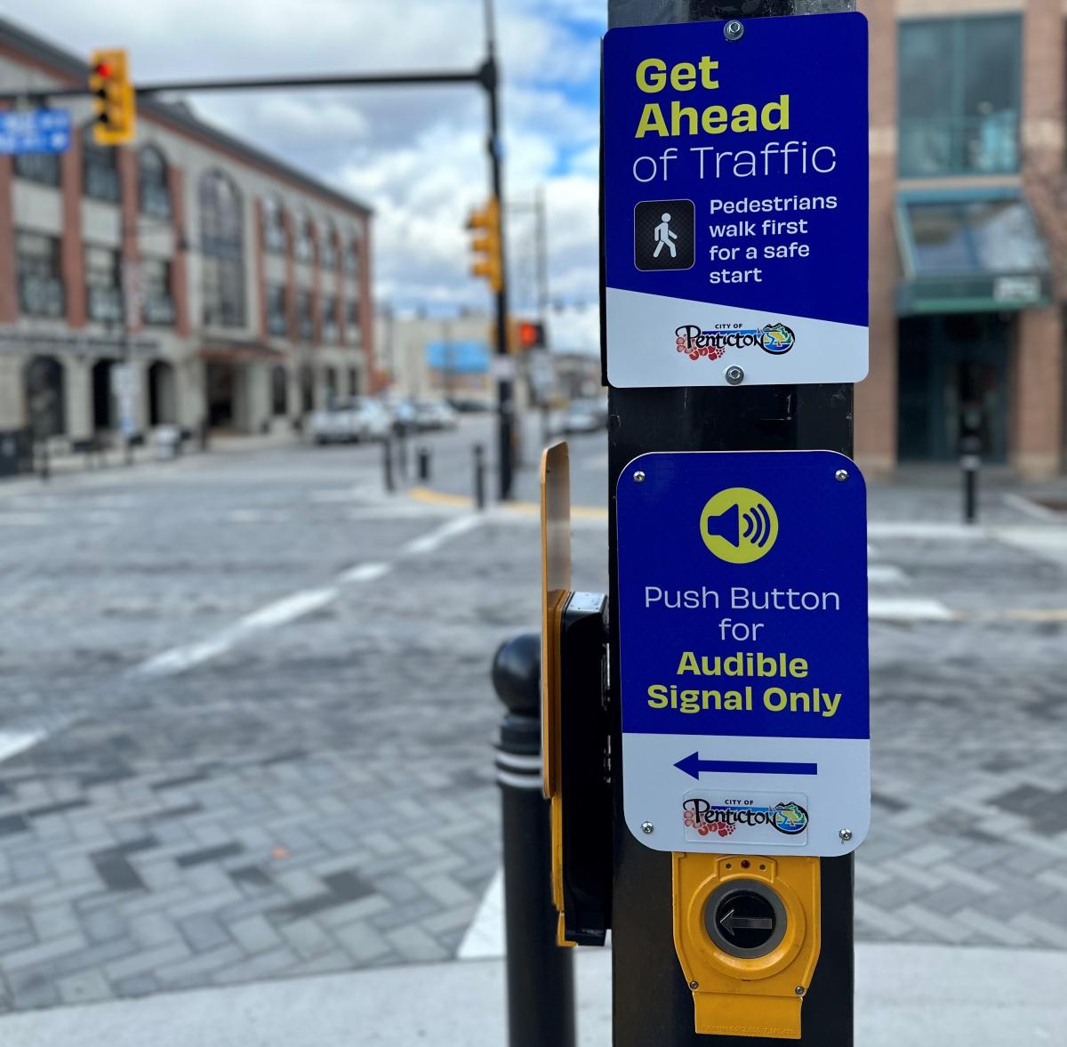
Our mobile-friendly city is home to a growing network of paths and routes that will connect you to lakes, parks, schools and businesses. Thanks to Penticton's compact geography, combined with great weather for most of the year, there are a number of ways to move around the community.
The Lake to Lake Route is now complete, providing a 6 km protected bike lane through the centre of the city, intended to make cycling convenient and safe for residents of all ages and abilities. Also visit our Trails page to scope out your off-road routes.
E-scooters
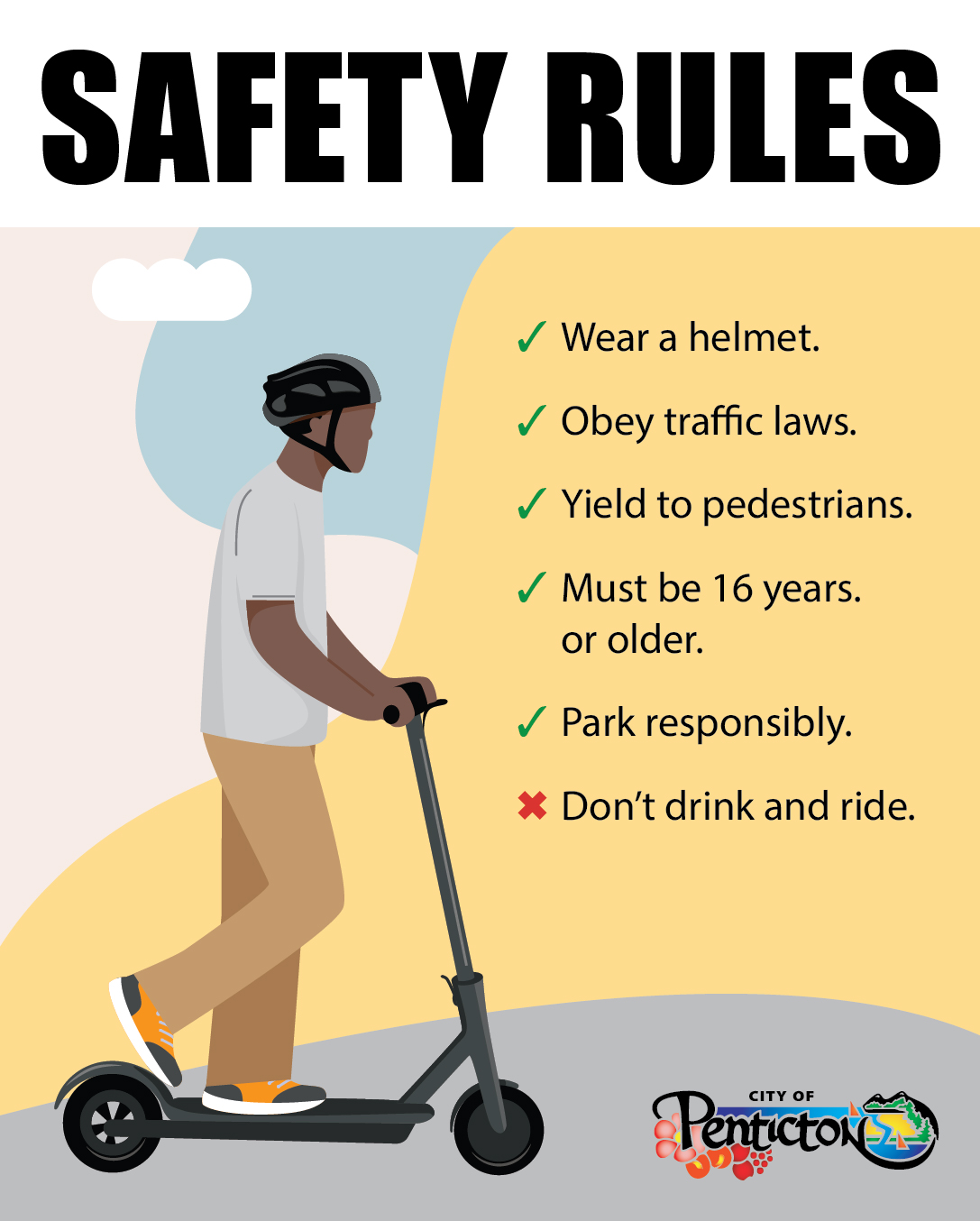
The City of Penticton is participating in the provincial Electric Kick Scooter Pilot Project to play an active role in shaping future e‑scooter regulations. This initiative supports Council’s strategic priorities by expanding active transportation options and advancing mobility and climate action goals.
Through the pilot, the City may permit the use of electric kick scooters in Penticton, including both privately owned scooters and shared, short‑term rental services provided by Bird Canada. Electric kick scooters provide an affordable transportation option for people with limited mobility, limited income, or those without a driver’s licence. E-scooters also provide a low‑emission alternative to motor vehicles.
Frequently Asked Questions
Cycling
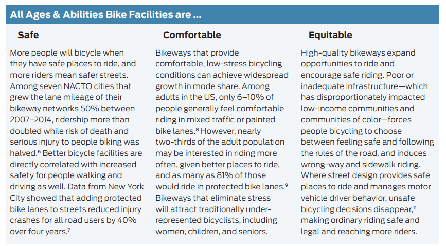
Cycling continues to climb each year as a desirable mode of transportation in Penticton. In fact, we have seen 20-30% growth annually on the Lake to Lake Route since the first section was complete.